Archivalie des Monats: Erste Umrundung der Insel Tasmanien - Die Kaart van Basses Straat
Every month, the German Maritime Museum (DSM) / Leibniz Institute of Maritime History presents a special treasure from the archive in the "Archival item of the month" series. In October, Dr. Frederic Theis recalls the discovery of the island of Tasmania with a historical nautical chart.
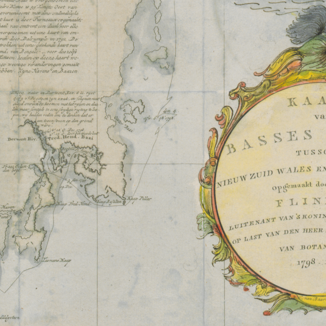
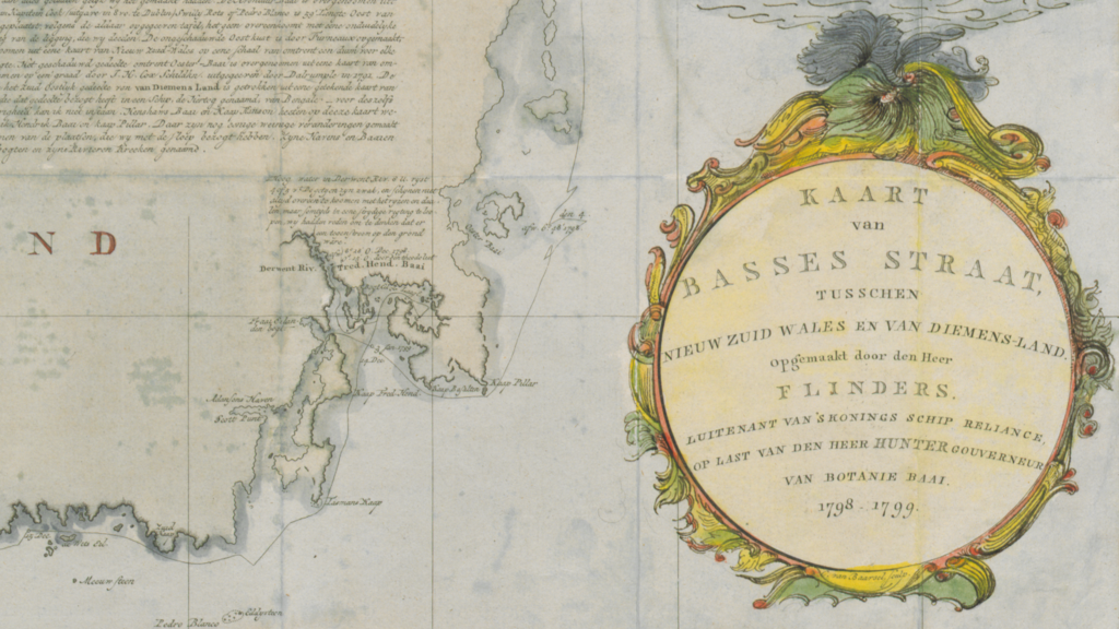
On January 12, 1799, the British captain and sea cartographer Matthew Flinders (1774-1814) and his compatriot, the physician George Bass (1771-1803), returned to the port of Port Jackson, Australia, from an expedition they had set out on the previous October. In the southern summer, they had taken the NORFOLK, a "colonial sloop" of the Royal Navy, as a tiny research vessel some 1,600 nautical miles south along the Australian mainland coast (New South Wales) and then around the island of Van Diemens Land (Tasmania since 1856). In doing so, they sailed through the strait between the island and the Australian mainland, which would henceforth be called Bass Strait (Dutch: Basses Straat) - and thus documented the island character of Tasmania for the first time.
The colored Dutch "Kaart van Basses Straat, tusschen Nieuw Zuid Wales en Van Diemens-Land", 74 x 50 cm, most likely made after an English original from around 1802/1803, now depicts the NORFOLK's route, marked as a solid line. On the one hand, the many changes of direction reveal the challenging, yet typical handling of the small vessel when sailing towards destinations that were often upwind. On the other hand, it shows how almost the entire coastline was carefully scanned and documented for bays, estuaries and other geographical features by means of a "running survey". As a result, it was possible to accurately trace the coastline on this map sheet, with the exception of a longer section on the eastern edge of the island and a few minor missing sections. The map sheet is illustrative in that it shows the course of the exploratory voyage. It was not until 1810 that London began to prepare the voyage report for publication, as well as the actual accurate nautical charts, which were based on the observations made by Flinders and his companion almost a decade and a half earlier.
Added by an anonymous hand to this copy of the map are both the multicolored decoration of the text vignette at the bottom right and the drawing of a brig, whose hull contours already clearly point to the 19th century.

The Kaart van Basses Straat - historical map of Tasmania.
Photo: DSM / Archive
Section of the historical map of Tasmania.
Photo: DSM